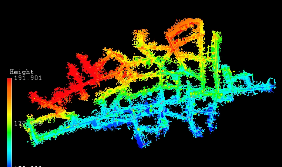
Laser scanning
We specialize in providing a complete suite of advanced laser scanning services, transforming your physical assets and environments into precise, actionable digital data. By integrating a versatile range of cutting-edge technologies, we deliver a holistic view of your project with unparalleled detail and accuracy. Our mission is to provide a reliable single source of truth that empowers architects, engineers, and construction professionals to eliminate guesswork, mitigate risk, and execute their vision with absolute confidence.


Perfect client
Our ideal client is someone who values precision, efficiency, and forward-thinking solutions—whether you're an architect, engineer, construction manager, or property owner. You’re likely managing complex projects where accurate, up-to-date measurements are critical for planning, renovation, or documentation. You understand the cost of errors and delays, and you’re looking for a reliable partner who can deliver high-resolution 3D data quickly and seamlessly. If you’re seeking a smarter, faster way to capture reality and transform it into useful digital models, then you're exactly who we’re here to support.
Laser scanning technologies
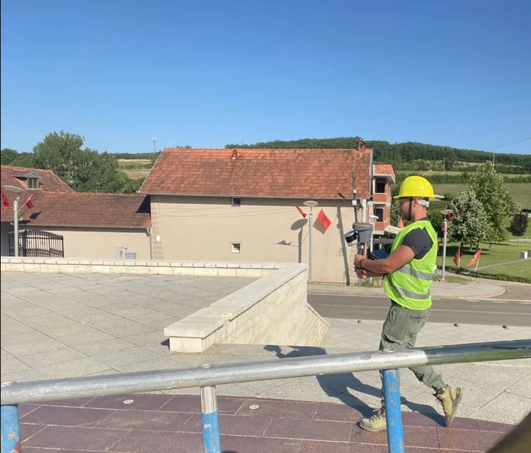
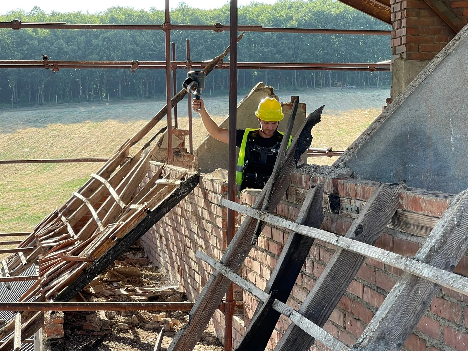
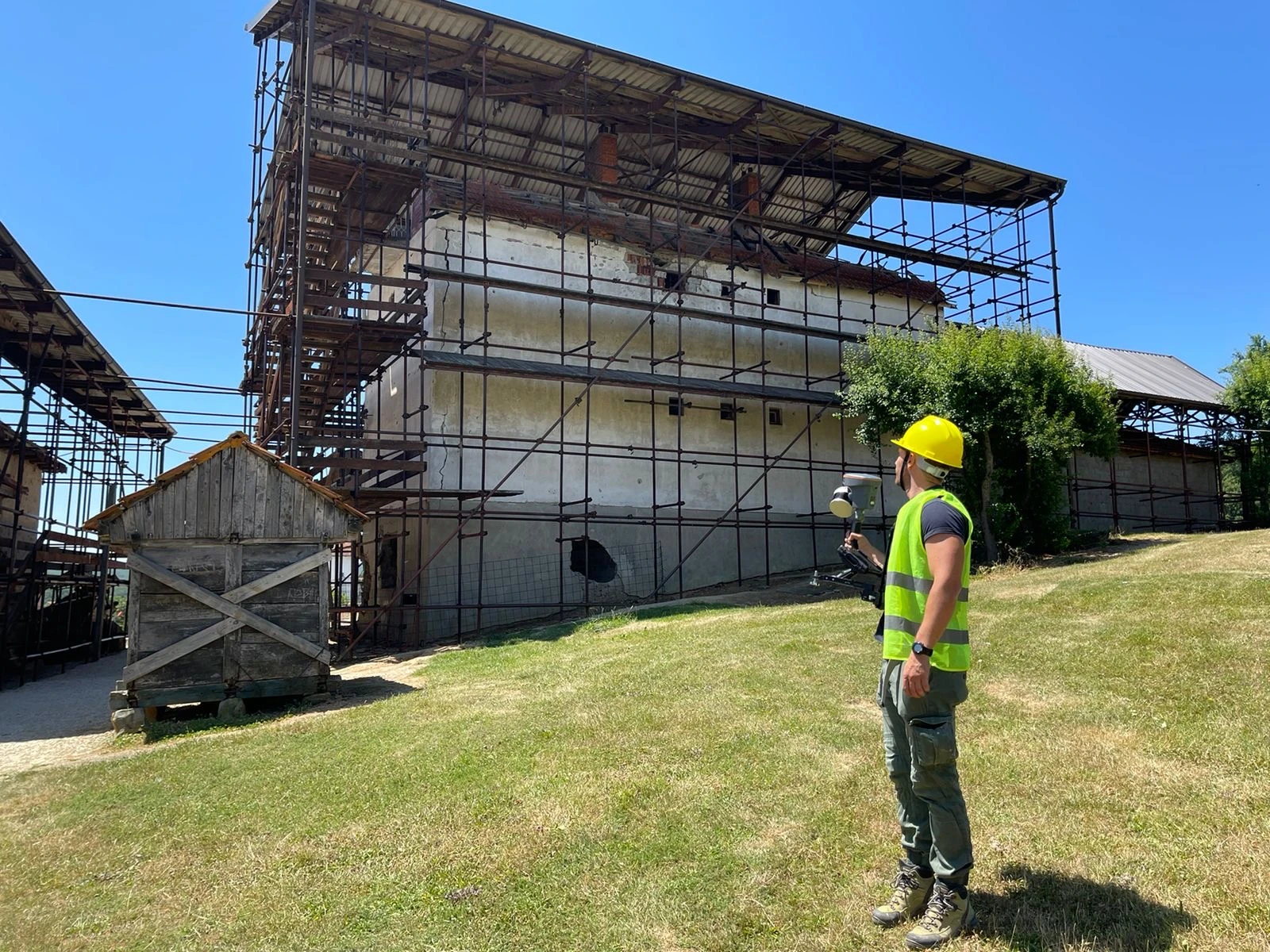
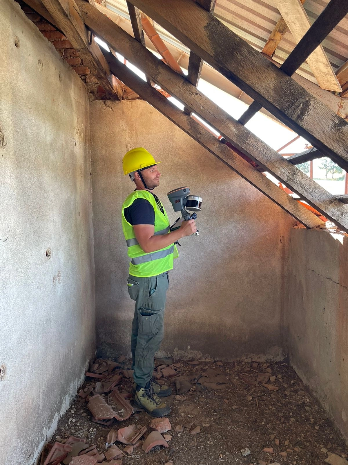
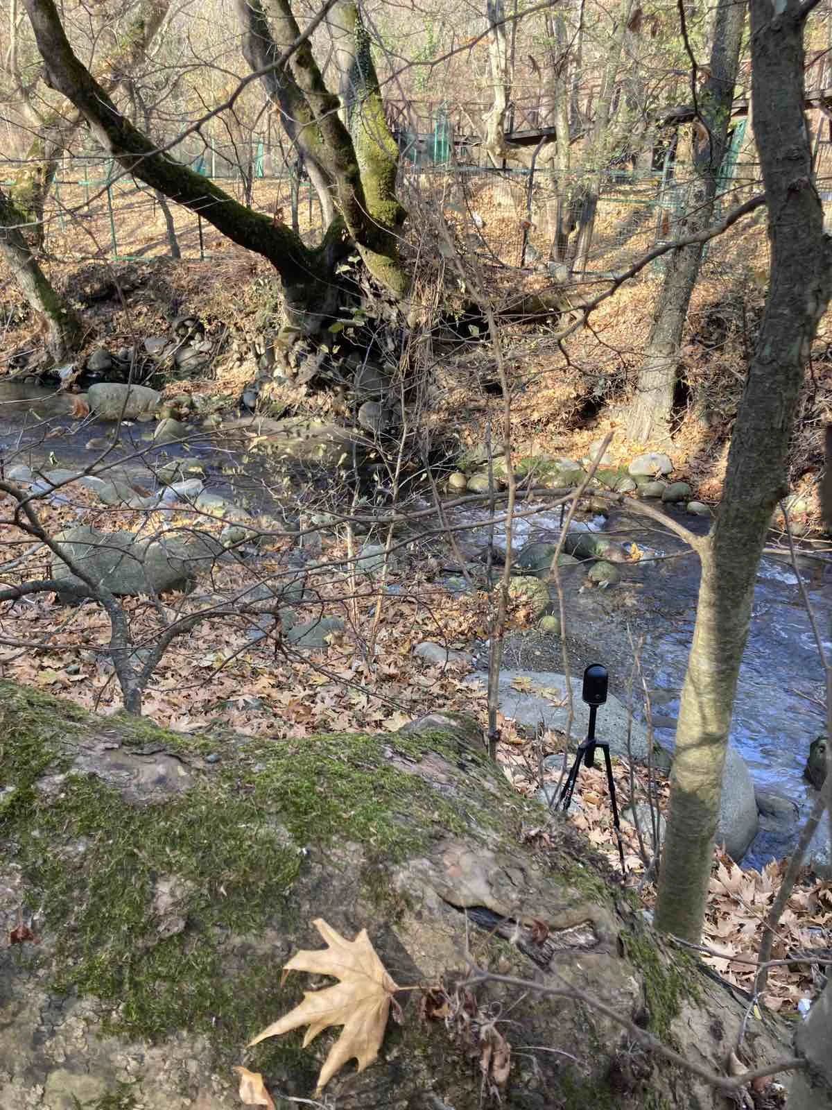
SLAM - Simultaneous Localization and Mapping - Mobile laser scanner
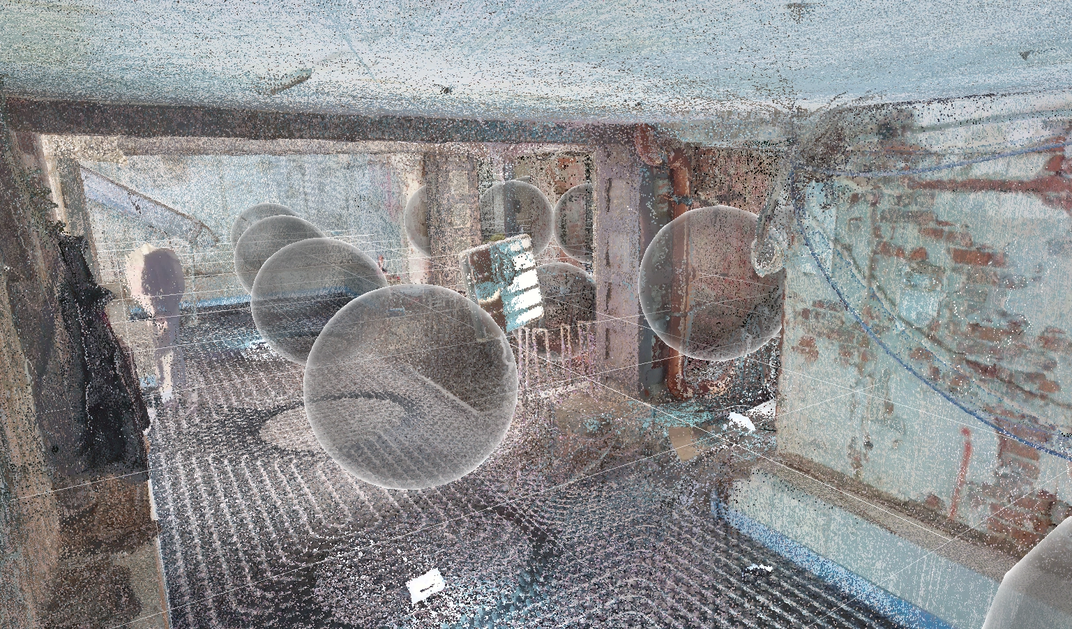
Mobile SLAM (Simultaneous Localization and Mapping) scanners technology is designed for speed and efficiency, allowing us to rapidly capture complex, multi-level, or hard-to-reach areas with minimal disruption. SLAM is the perfect solution for mapping intricate structures, documenting active construction sites, or capturing large areas quickly. It provides a comprehensive overview of a space, capturing data on the move to ensure no detail is missed.

TLS - Terrestrial laser scanner
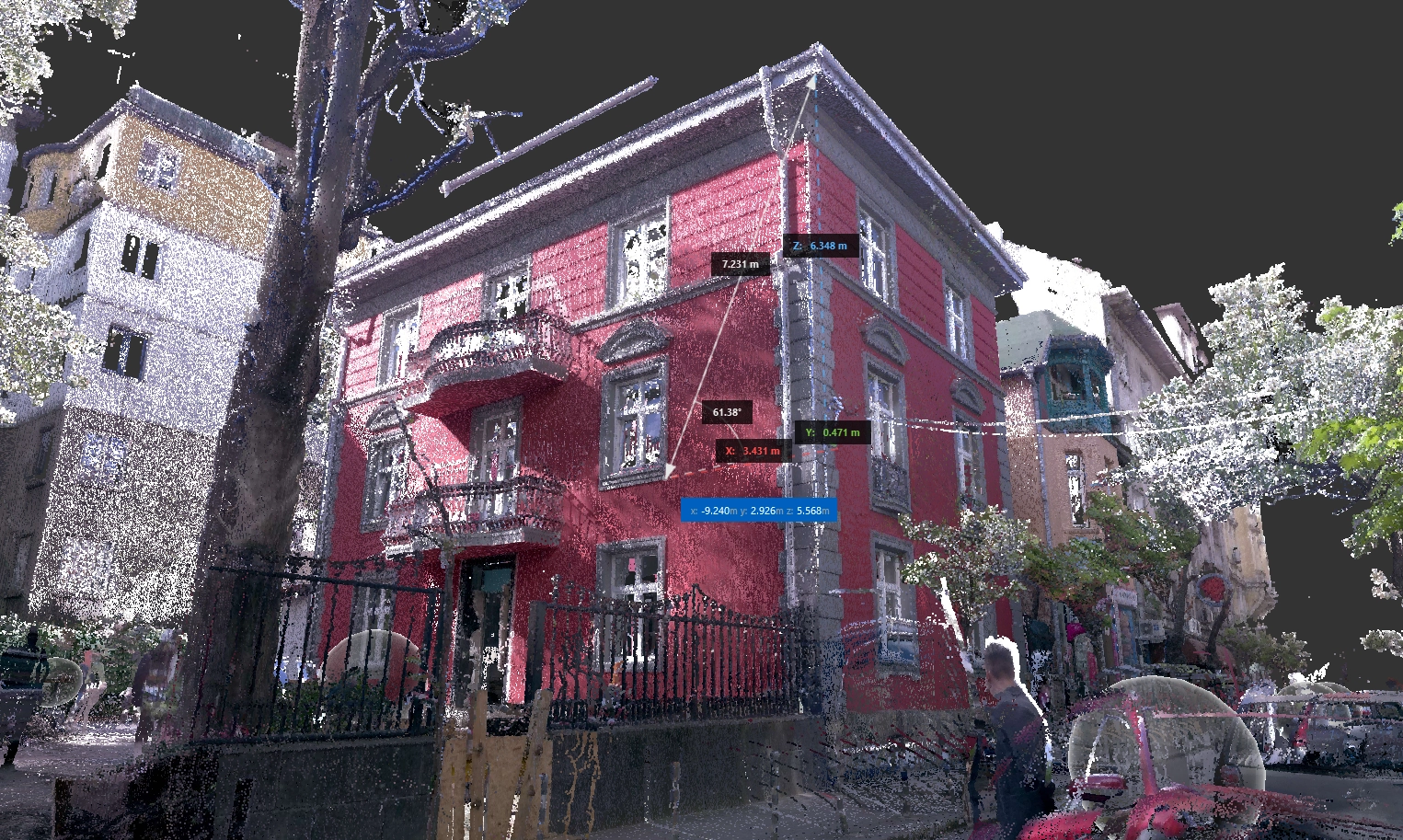
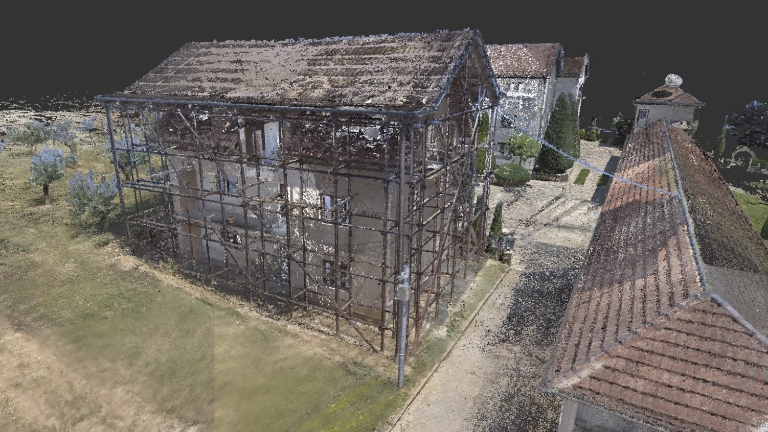
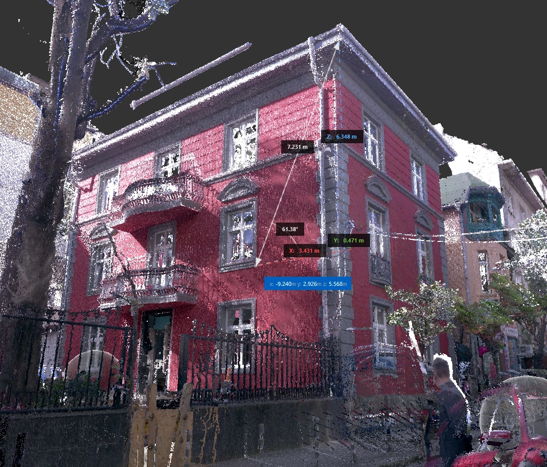
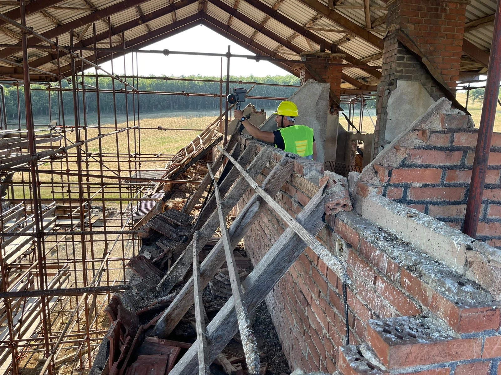
For projects demanding the highest level of accuracy, we employ Terrestrial Laser Scanners (TLS). This method is ideal for capturing engineering-grade data of buildings, infrastructure, and industrial facilities where precision and details are main focus. By taking multiple static, high-resolution scans, we create an exceptionally detailed point cloud with high-level accuracy. This foundation is perfect for producing precise as-built documentation and ensuring seamless integration with Building Information Modeling (BIM) workflows.
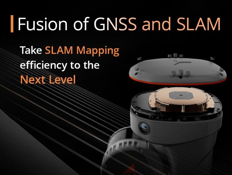
Georeferencing - GNSS receiver
The crucial final step in our process is anchoring your data to the real world. By integrating high-precision GNSS (Global Navigation Satellite System) receivers, we elevate a standard point cloud into a fully georeferenced digital twin. This process assigns precise, real-world coordinates to your data, ensuring it aligns perfectly with all other survey and design information. A georeferenced point cloud provides ultimate context, enabling accurate site-wide planning, confident decision-making, and seamless collaboration across all project phases.
Laser scanning applications

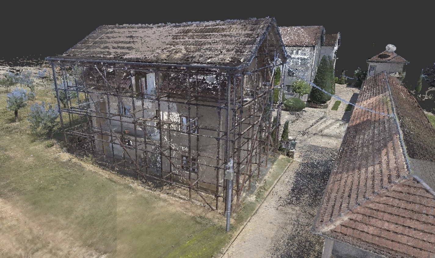
Architecture, Engineering, and Construction (AEC)
The AEC industry has been a primary beneficiary of laser scanning. It is used throughout the entire lifecycle of a building or infrastructure project.

Interior design
Laser scanning captures the exact dimensions and geometry of a room, including imperfections like wall bows or floor slopes that are often missed by manual measurements. This digital precision ensures that everything from custom cabinetry to furniture will fit perfectly, eliminating costly ordering mistakes and rework.
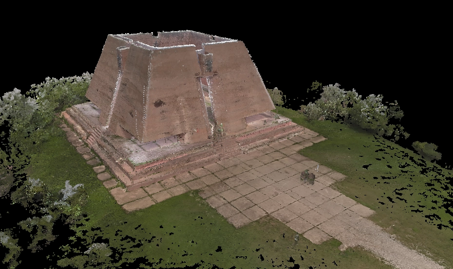
Cultural Heritage and Archaeology
The non-contact nature of laser scanning makes it ideal for documenting and preserving our shared history.
Forensics and Public Safety
Laser scanning has become an invaluable tool for law enforcement and forensic investigators
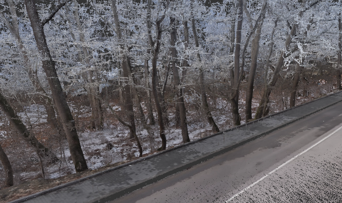
Forestry and Environmental Monitoring
For assessing forest canopy structure, biomass estimation, and monitoring changes in landscapes over time.
Other Applications
The versatility of laser scanning extends to numerous other fields
Case studies
Interior design
In interior design, laser scanning is used to rapidly create a perfectly accurate 3D digital model of an existing room or building interior. This eliminates the need for manual measurements with a tape measure, preventing human error and capturing complex details with ease.
Ultimately, laser scanning provides a reliable digital foundation, saving time, reducing costly measurement mistakes, and allowing designers and clients to accurately visualize the final space before purchasing the wrong items.


3D modeling
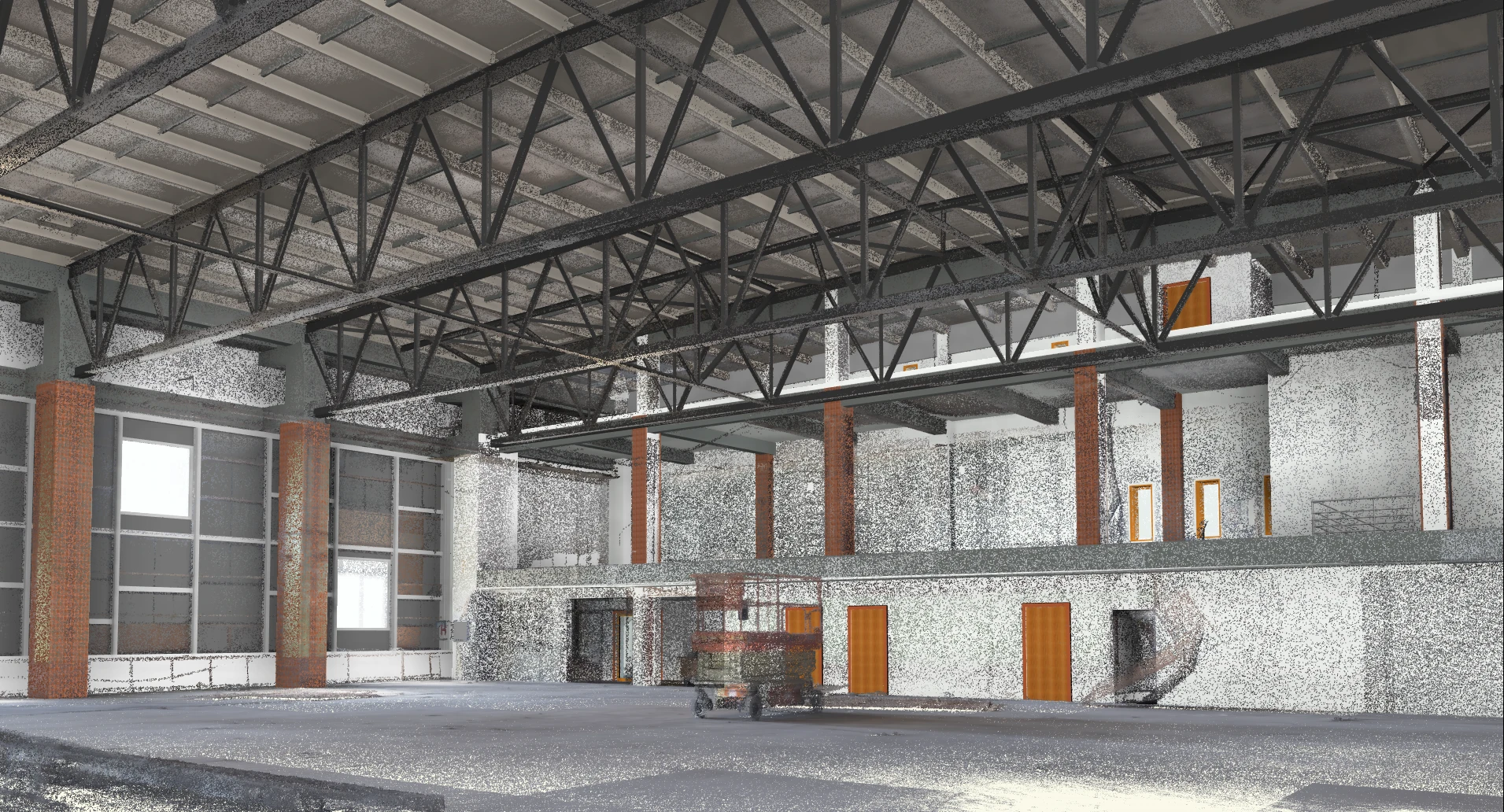
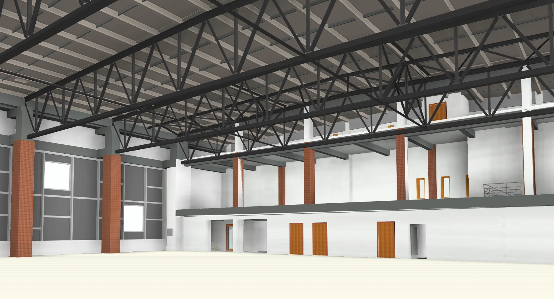
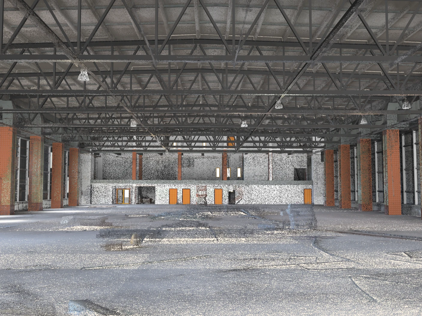
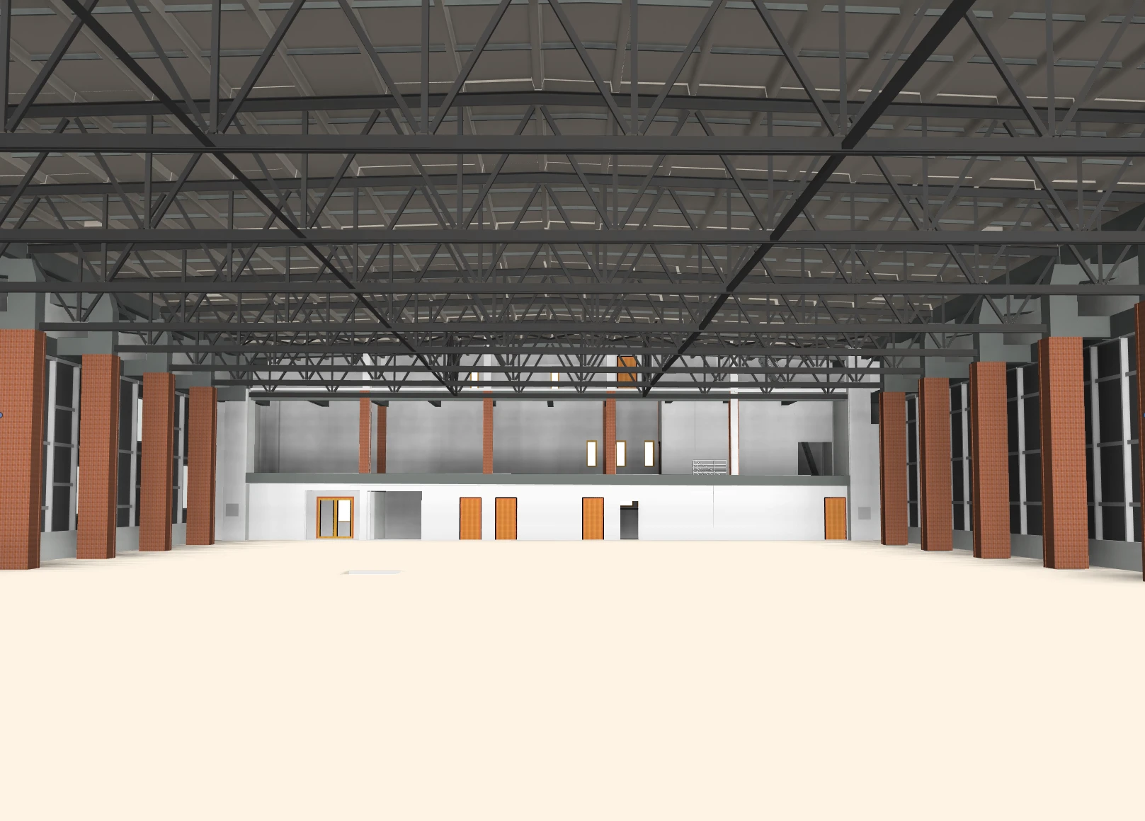
In the context of laser scanning, 3D modeling is the process of converting the raw data captured by a laser scanner—a vast collection of individual points known as a "point cloud"—into a solid, intelligent, and usable 3D model.
In essence, laser scanning provides the highly accurate raw data of the real world, and 3D modeling gives that data structure, substance, and utility, turning it into a functional digital twin that can be used for design, analysis, verification, or visualization.


Clash detection
Clash detection is the process of using a 3D laser scan of an existing site to identify potential physical interferences ("clashes") with a new design before construction begins.
Laser scanning provides a perfect digital copy of the real-world conditions, and clash detection uses this copy to "test-fit" the new design virtually. This allows architects and engineers to find and resolve conflicts on a computer screen, preventing costly and time-consuming rework, change orders, and delays during the actual construction phase.


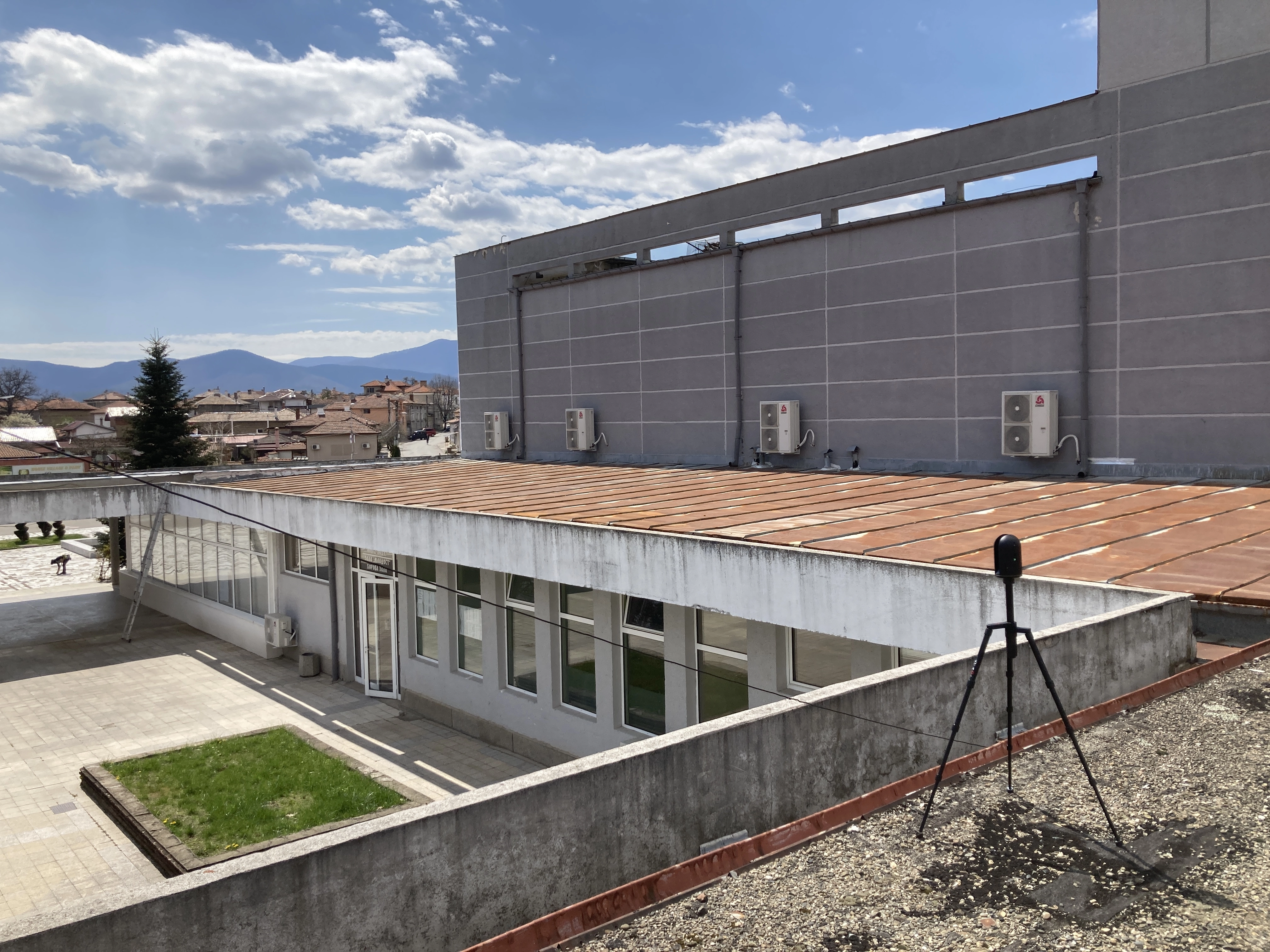
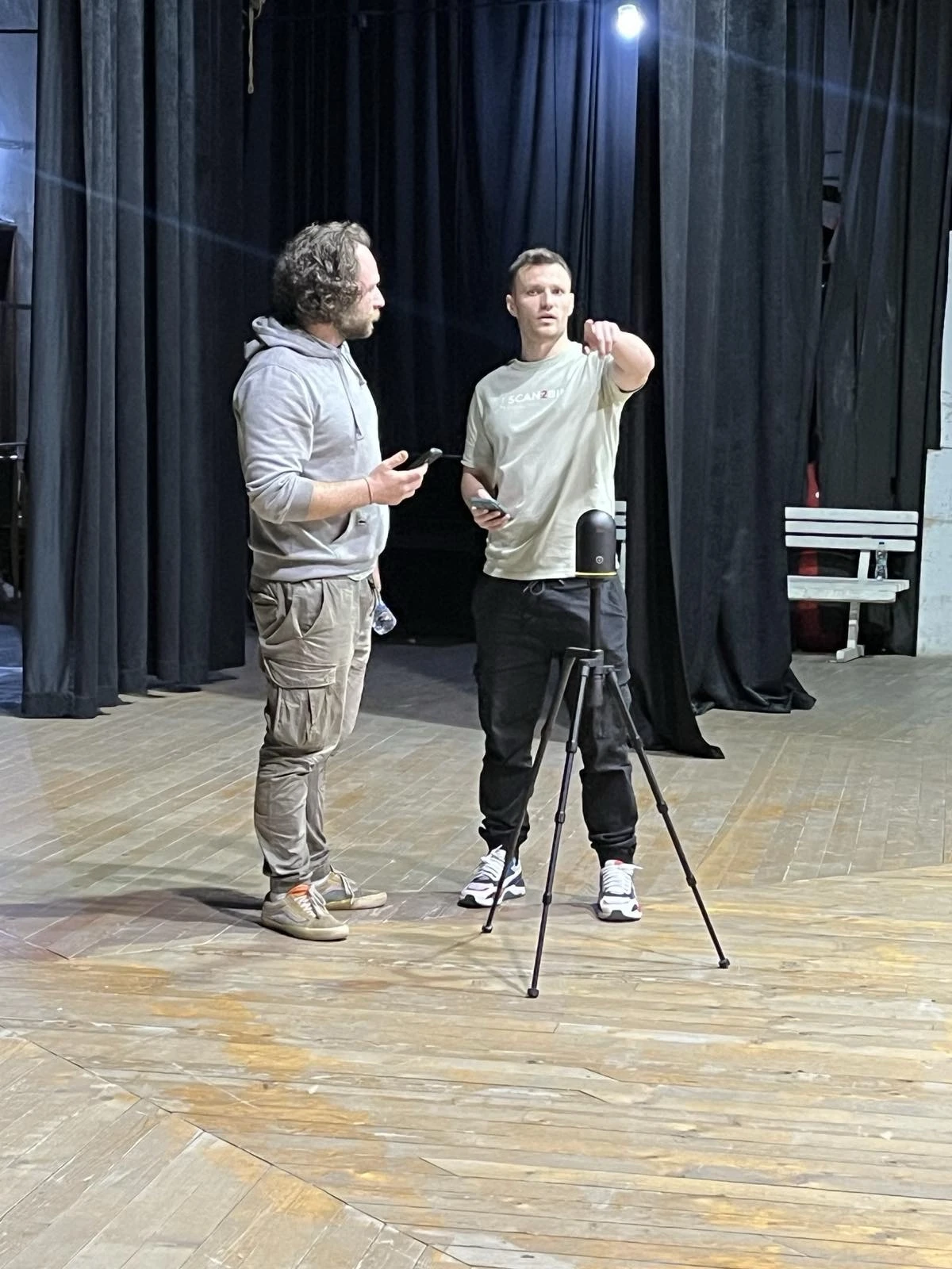
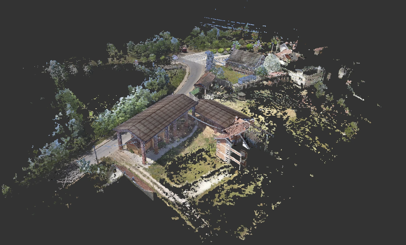
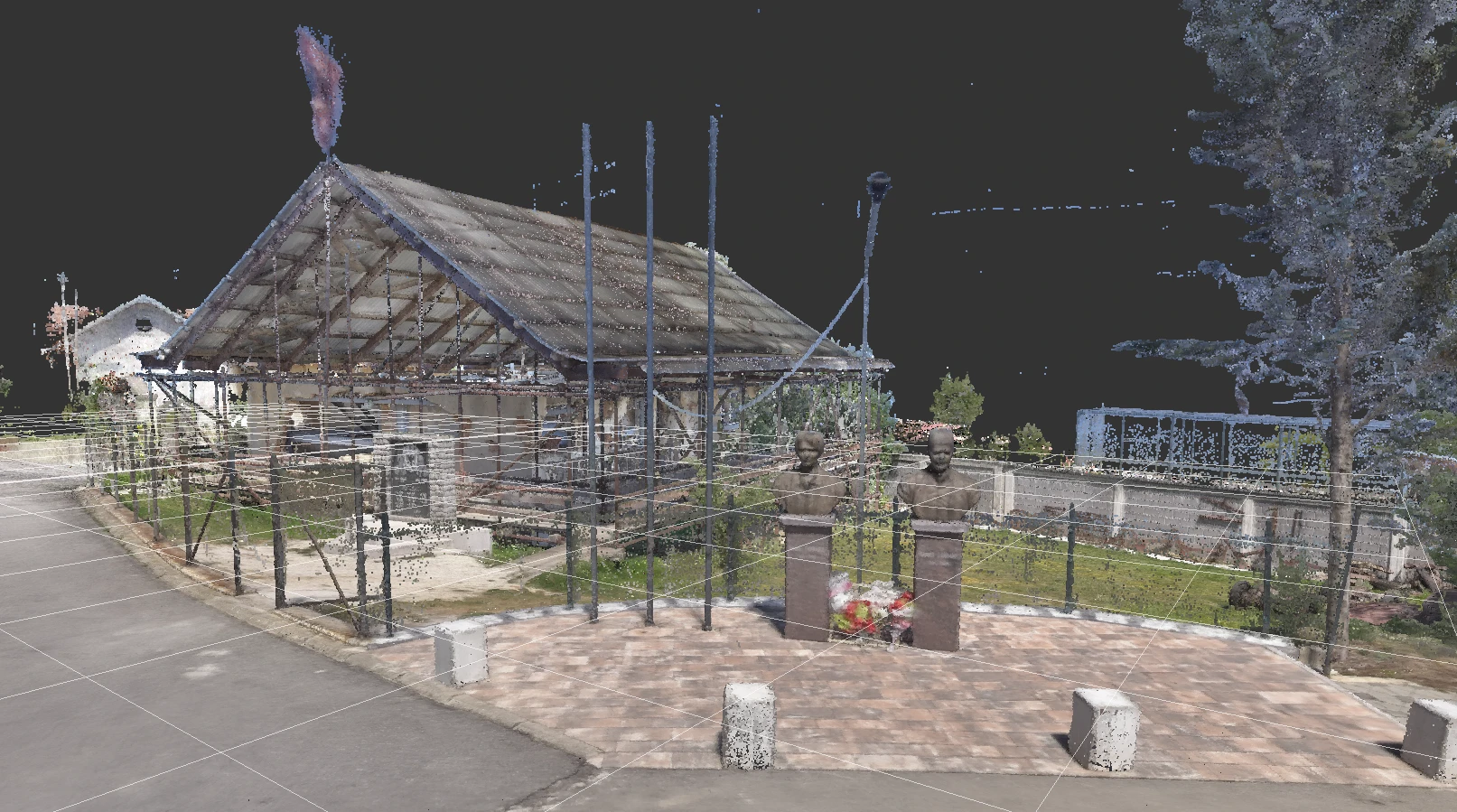
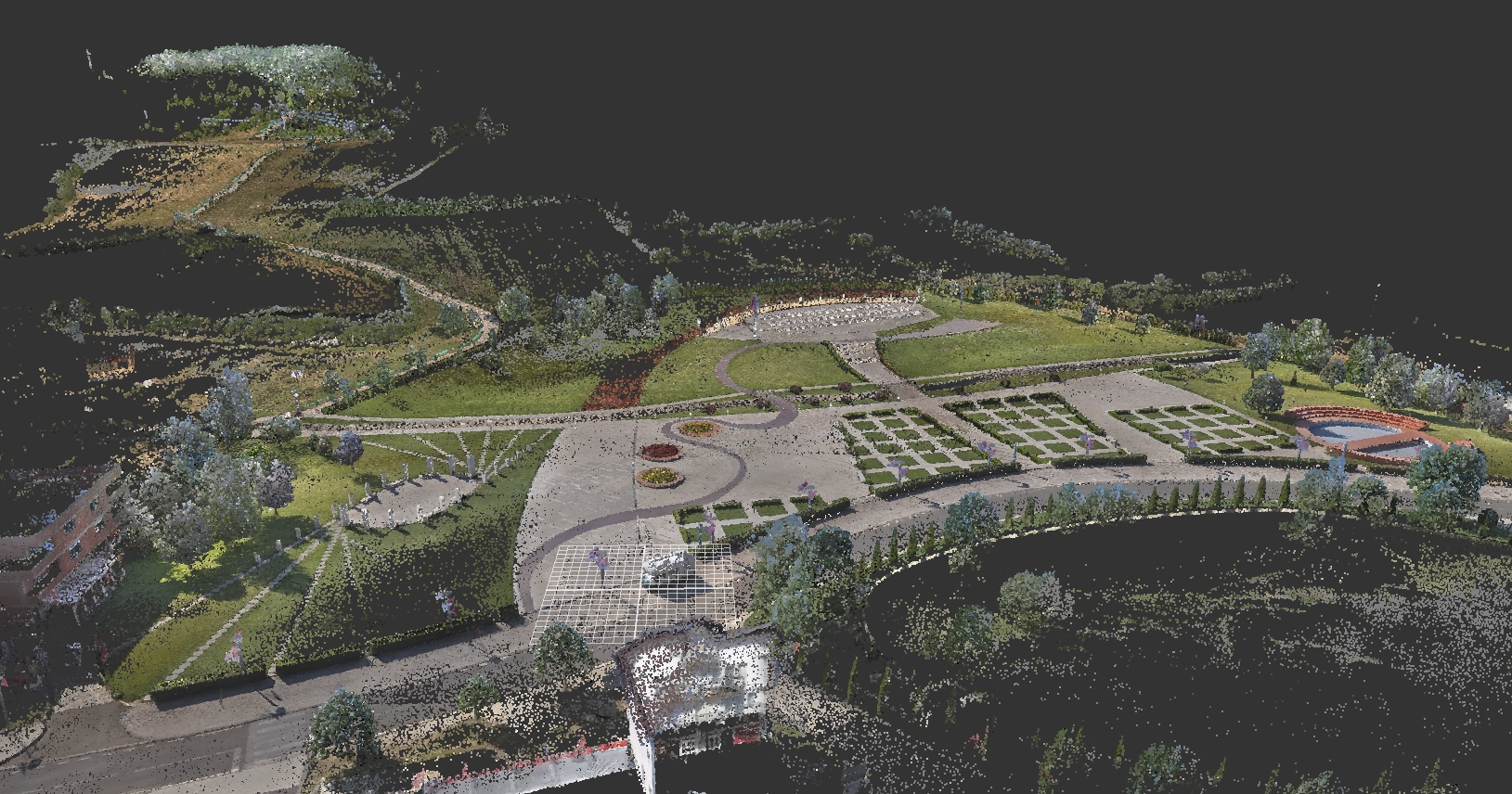
Work examples